While this site concentrates on Hertfordshire it is important to remember that, with the exception of parts of the rivers Lea and Stort, the county has no significant natural boundaries. Typically the county boundaries were based on tracks and hedgerows which formed the boundaries of Saxon estates over a thousand years ago. Before the boundary was rationalised Ashridge House (centre of this map) was half in Hertfordshire and half in Buckinghamshire.
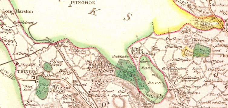 |
| From Cary's 1811 map of Hertfordshire |
Most of the narrow finger of Buckinghamshire that runs down to Nettleden is part of the parish of Pitstone, Bucks, although some is actually a detached part of the parish of Ivinghoe, Bucks. Needless to say many of the people who lived in Nettledon preferred going to the nearby church of Great Gaddesdon, Hertfordshire.
What this means is that if you are to take researching your ancestors seriously you must remember that in some cases, when your ancestor crosses the county boundary to get married, his bride-to-be will be living in the house next door. So can you answer the question below the fold: