Showing posts with label County Boundary. Show all posts

Saturday, November 17, 2012

Just popping into Buckinghamshire to get married

While this site concentrates on Hertfordshire it is important to remember that, with the exception of parts of the rivers Lea and Stort, the county has no significant natural boundaries. Typically the county boundaries were based on tracks and hedgerows which formed the boundaries of Saxon estates over a thousand years ago.  Before the boundary was rationalised Ashridge House (centre of this map) was half in Hertfordshire and half in Buckinghamshire. 

From Cary's 1811 map of Hertfordshire
Most of the narrow finger of Buckinghamshire that runs down to Nettleden is part of the parish of Pitstone, Bucks, although some is actually a detached part of the parish of Ivinghoe, Bucks. Needless to say many of the people who lived in Nettledon preferred going to the nearby church of Great Gaddesdon, Hertfordshire.

What this means is that if you are to take researching your ancestors seriously you must remember that in some cases, when your ancestor crosses the county boundary to get married, his bride-to-be will be living in the house next door. So can you answer the question below the fold:

Tuesday, May 1, 2012

A Detour into Buckinghamshire

One of the frustrations of this web site has been that I live in Tring - which is the western part of Hertfordshire which is surrounded on three sides by Buckinghamshire. I enjoy walking the countryside, taking photographs of features of historical interest and well as the wild life and farming activities. With the Vale of Aylesbury to my north, and the Chiltern Hills to the east and west there is much to keep me occupied - but most of it is in Buckinghamshire.

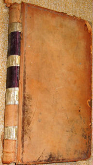
William Brown's Account Book
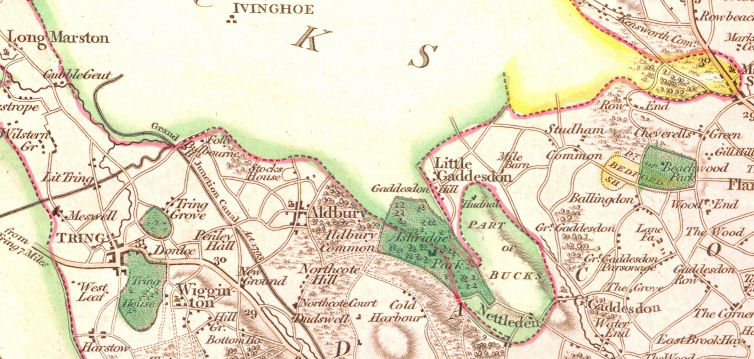
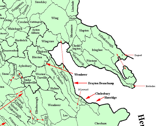
The point is that the county boundaries of Hertfordshire are in most places highly arbitrary - and mainly derive from the boundaries of Anglo-Saxon estates over 1000 years ago. While administrative history may limit itself to such boundaries they are for most purposes arbitrary lines which in some place are not even marked by as much as a hedgerow. Treating the county boundary as a rigid "no-cross" line causes significant difficulties if you are discussing local history.

One example relates to Tring as a market Town - when many of the people who used the market to buy and sell would have crossed the county boundary to do so. William Brown was an auctioneer in Tring in the 19th century and, when I have time, I am presenting details of his Customer Account Book which again deals with customers on either side of the boundary.

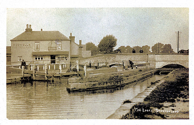
The Lock at Startops End
Another example relates to the Canal, its branches, and its reservoirs, where any account of its history automatically involves both Herts and Bucks - particularly the Bucks village of Marsworth.

To make it easier to cover issues which cross the county boundary it has been decided to introduce pages for Buckinghamshire parishes which are associated with the canal, plus some adjacent parishes in the Vale of Aylesbury. Each page will consisted of one or two old post cards images and links to my modern photographs, which will be held as high resolution images on Geograph. There will also be links to cross-boarder topics on the Hertfordshire web site and external links to other relevant web sites. There will be no attempt to duplicate the excellent information on Buckinghamshire GENUKI.

To get this rolling the Buckinghamshire page has been updated, together with demonstration pages for Marsworth (which includes a significant section of the Grand Union Canal) and Aston Clinton (which includes short sections of the Aylesbury and Wendover Arms of the Canal, and the site of a former Rothschilds House.) This will be considered a low priority project with perhaps one or two place pages added each month.

Saturday, April 21, 2012

Markyate - On the County Boundary with Bedfordshire

Until 1877 the village of Market Street, or Markyate, was in three separate ecclesiastical parishes - Studham, Caddington and Flamstead and later became a civil parish in 1897. This causes difficulties as to knowing what the records mean, and where the records are held. For instance someone living in the house they were born in at the time of the 1901 census may be living in Markyate but Markyate (as a parish) did not exist when they were born - so what will they record as their place of birth. In addition civil registration records might be in Hemel Hempstead, Herts, or Luton, Beds.

This post has arisen because the help messaging facility has been broken and as a result I have been feeling somewhat deprived as I have had fewer help requests than usual . I saw a request linked to Markyate on Rootsweb relating to the birth of a Mary Vass (possibly in the Markyate area) circa 1780 and her death as Mrs Mary Cain circa 1861. You may see the original request, and my reply, on Rootsweb - but I have also posted them as VASS/CAIN. Markyate, late 18th & 19th centuries on this site - with added links.

Saturday, January 21, 2012

Across the County boundaries around Barnet

Loz contacted me because of difficulties in locating birth details of Joseph Rolph and I was able to find him - see ROLFE, Monken Hadley, 1800-1851. The problem is that in the 1871 census Joseph gave his place of birth at Barnet - which was then in Hertfordshire - but he had actually been born just over the county boundary in Monken Hadley, which was then in Middlesex but became part of Hertfordshire in 1903. Both Barnet and Monken Hadley became part of Greater London when the County of Middlesex was abolished as an administrative unit! The lesson is that if your ancestors came from the Barnet area you need to check both the Hertfordshire and Middlesex records.