When this site was started over 10 years ago there were very few old maps on line - but things have changed enormously and a whole range of Ordnance Survey and other maps can be viewed quickly and easily. But many people still like handling maps on paper, and while Old Maps will provide you with a customised paper map centred on your ancestral home, original larger scale Ordnance Survey maps are hard to come by. It may be old news to many - but large scale maps of many Hertfordshire towns in the late 19th century were published some years ago as "
The Godfrey Edition" and are still available. To help you find the maps I have added the names of the places covered [
Baldock, Berkhamsted, Boxmoor, Chorleywood, East Barnet & Southgate, Harpenden, Hatfield, Hemel Hempstead (North, South), Hertford (North, South), Hitchin, Hoddesdon, Rickmansworth & Croxley Green, St Albans (NE, NW, SE, SW), Tring, Ware, Watford, South Watford & New Bushey] to my
Ordnance Survey Maps page. (Similar maps are also available for other counties.)
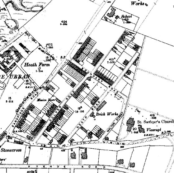 |
| An example of the detail you will find on the Godfrey Edition Maps |


No comments:
Post a Comment
This is the newsletter for the Genealogy in Hertfordshire Web site. Comments on this blog are moderated and may be transferred to the web site where appropriate. If you have a local or family history query you want answered you must use "Ask Chris" - See box in right hand column. Anonymous comments cannot be answered.