 |
| Hertfordshire Maps |
 |
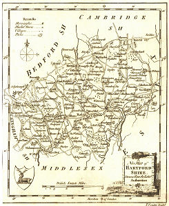
| Conder's Map of 1784 |
Initially three map pagess have been provided with high definition images - these are:
For anyone visiting my web site the only significant change is that when you click on the blue-framed map a new page will open with the Wikimedia image. However all high definition images will be widely available via the Hertfordshire: Early Maps page on Wikimedia Commons, and the source will lead you to a page containing more information.

No comments:
Post a Comment
This is the newsletter for the Genealogy in Hertfordshire Web site. Comments on this blog are moderated and may be transferred to the web site where appropriate. If you have a local or family history query you want answered you must use "Ask Chris" - See box in right hand column. Anonymous comments cannot be answered.